


Latest Philadelphia Weather Update: December 15, 2025 – Bitter Cold

Latest Philadelphia Weather Update: December 15, 2025 – Bitter Cold
Philly Weather Forecast: Snow Accumulations from Weekend Storm, Frigid Temps Ahead – NBC10 and Local Insights
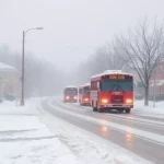
As of December 15, 2025, Philadelphia is experiencing the aftermath of a significant weekend winter storm that brought widespread snowfall across the region on December 14. Residents are dealing with bitter cold temperatures, gusty winds, and icy conditions following 3-8 inches of snow in most areas. Here’s the latest Philadelphia weather update, including current conditions, snow totals, and the extended forecast from sources like NBC10, CBS Philadelphia, and the National Weather Service.
Current Conditions in Philadelphia (as of Morning December 15)
- Temperature: Lows in the teens (around 17°F overnight), with daytime highs struggling to reach the upper 20s to low 30s°F.
- Conditions: Partly cloudy to mostly clear, brisk and bitterly cold with gusty northwest winds (15-25 mph, higher gusts possible).
- Feels-Like: Single digits to teens due to wind chills – dangerous for extended outdoor exposure.
- Roads: Icy spots persist; travel remains hazardous despite cleanup efforts.
Weekend Snow Recap (December 14 Storm)
A Winter Storm Warning was in effect Saturday night through Sunday morning, delivering the season’s first major snowfall:
- Philadelphia City: 3-5 inches (e.g., Center City ~3.6 inches, Northeast Philly 4-5 inches).
- Suburbs: Higher totals north and west – up to 8-9 inches (e.g., Blue Bell 8.7 inches, northwestern areas nearing 9 inches).
- Snow started late Saturday, intensified overnight, and tapered off by midday Sunday.
- No major disruptions reported post-Eagles game, but power outages possible from heavy, wet snow on lines.
This storm ended Philly’s recent snow drought, with accumulations varying widely across the region.
Extended Forecast for Philadelphia
- Monday (Dec 15): Partly cloudy, windy, and cold. High near 28°F, low around 17°F. Wind chills in the single digits.
- Tuesday: Mostly sunny but still frigid. High ~30°F.
- Mid-Week: Gradual warming trend – highs climbing to the 40s-50s by Thursday.
- Precipitation: Dry for now; watch for possible snow squalls early week.
- Longer Term: Colder-than-average streak continues early week before moderating.
Safety Tips
- Bundle up against extreme cold – risk of frostbite.
- Watch for black ice on roads and sidewalks.
- Check on vulnerable neighbors during this Arctic blast.